Subscribe

Camas leaders dive into climate goals, hazard mitigation

City’s biggest climate risks include extreme heat, heavy precipitation, flooding and wildfires

By
timestamp icon
category icon Camas, Environment, Latest News, News
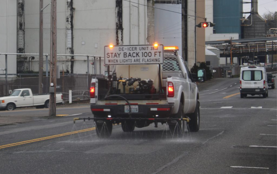
A city of Camas de-icing vehicle sprays de-icer along Northeast Sixth Avenue, near the Georgia-Pacific paper mill in downtown Camas, Friday, Jan. 12, 2024, ahead of a winter storm expected to drop 2 to 4 inches of snow on the greater Vancouver area. Camas officials are digging into the city's carbon emissions and setting goals to mitigate future climate hazards, including heavy precipitation, flooding, wildfires and extreme heat. (Kelly Moyer/Post-Record files)

The Camas Planning Commission is diving into the city’s greenhouse gas emissions and seeking ways to mitigate future climate hazards in the region.

During their Oct. 15 meeting, the commissioners heard from Camas Development Director Alan Peters and consultants from WSP and Parametrix about work that has already gone into the City’s “Our Camas 2045” comprehensive planning under new state guidelines that, in 2023, amended Washington state’s Growth Management Act to include a climate goal and mandated that local jurisdictions include climate-change elements — including resiliency in the face of future climate-related weather events — to their comprehensive plans.

“As part of this, the entirety of Clark County conducted a community greenhouse gas (GHG) inventory for their 2025 Comprehensive Plan Update,” Parametrix consultants stated in their executive summary for the Camas Community Greenhouse Gas Inventory presented to the planning commission in October. “This inventory for Camas is part of this larger effort and will help set targets and strategies to reduce GHG emissions and decrease per capita vehicle miles traveled.”

The report noted that Good Company, a division of Parametrix, conducted the greenhouse gas analysis on behalf of Clark County and that the project was funded by Washington’s Climate Commitment Act, a law more than 60% of Washington state voters upheld during the Nov. 5 general election.

Peters told the commissioners that House Bill 1181, enacted by the Washington State Legislature in 2023, requires all Growth Management Act cities to adopt plans to reduce their greenhouse gas emissions and to “plan for actions to reduce adverse impacts of climate change to the community.”

“This changes the way we plan our infrastructure, plan our community and respond to disasters,” Peters said.

Greenhouse gas inventory in Camas

The City’s greenhouse gas inventory measured three of the most common greenhouse gases — carbon dioxide, methane and nitrous oxide — as well as other greenhouse gases the consultants described as having a “high global warming potential” such as human-made chlorofluorocarbons (CFCs) and hydrofluorocarbons (HFCs) used in refrigeration and air-conditioning.

The consultants measured the gases in metric tons of carbon dioxide equivalent (CO2e) and noted that one metric ton of CO2e is the equivalent of one gas-powered passenger vehicle traveling 2,500 miles or 13% the annual energy use in a typical U.S. home. The measurements included not just greenhouse gas emissions happening inside the city of Camas’ boundaries, including natural gas combustion and emissions from cars and trucks, as well as “consumption-based emissions from imported goods and food, fuel, air travel and the purchase of carbon offsets.

“We wanted to make sure you’re accounting for all of the different emissions affecting your community,” Claudia Denton, of Parametrix, told the City’s planning commissioners during their Oct. 15 meeting.

The City’s total emissions in 2022, for a population of 27,250 residents came out to 593,035 metric tons CO2e or 21.8 metric tons CO2e per capita, Denton said, noting that the highest source of local emissions was industrial process and product use at 124,881 metric tons CO2e, while the second, third and fourth highest contributors of local greenhouse gas emissions included building energy, or the energy usage in residential, commercial and industrial buildings and facilities (123,505 metric tons), transportation, including gasoline for passenger vehicles and diesel for freight and bus transit (61,245 metric tons) and solid waste (landfills) and wastewater (7,765 metric tons).

The highest sources of imported emissions included goods production (127,937 metric tons), food production (68,549 metric tons), fuel production (54,344 metric tons) and air travel (24, 810 metric tons).

“Energy used in buildings is Camas’ second largest source of local GHG emissions, accounting for 39% of local emissions,” the consultants noted in their report. “These emissions come from a mix of electricity, natural gas use and other … fuels, and they result in 123,505 (metric tons) CO2e. By energy type, natural gas had the largest impact (47% of total building emissions); closely followed by electricity (47%); and other fuels (6%).”

Transportation, the third-highest source of local emissions, showed that on-road passenger vehicles “were the leading source of local transportation emissions and are responsible for 69% of local emissions.”

Including air travel, Camas’ transportation-related greenhouse emission sources show passenger vehicles account for 49% of all transportation-related emissions, followed by air travel (29%), off-road fuel sales (11%), freight (9%), rail (1%) and electric vehicles (less than 1%).

And when it comes to industrial processes and products use (PPU) emissions, Camas is unique, consultants told the Camas Planning Commission.

Camas has more industrial emissions than an average community, Denton said, adding that what are known as “specialized fugitive gases,” or potent greenhouse gases up to 23,500 times as potent as carbon dioxide, have “contributed to the largest share” of Camas’ industrial emissions.

Denton said Camas officials would, “in terms of global action, be better off having good relationships with these businesses and helping them reduce emissions instead of driving them out of the community.”

The consultants said completing the greenhouse gas emissions study will help Camas officials develop a climate action plan.

“This is the first step,” Denton told the Commission. “Take a look at your emissions, see what the largest source of emissions are and what will fit your community. Those are your next steps.”

Peters said the information is useful to have during the City’s ongoing comprehensive plan update.

“It’s extremely useful information to develop these policies and goals,” Peters said. “The rule is, we have to reduce our emissions and vehicle miles traveled. It’s clear looking at the slides here that individual efforts are going to be a very, very small piece of the pie. The industrial sector is bigger than our transportation impact. We have a big task ahead of us and decisions to make in terms of what these (climate) goals will be.”

Denton added that, though “each person or business or community might feel like you have a very small amount of emissions, collectively that’s what makes up emissions.”

“Look at your sphere of influence,” she advised. “What are your biggest sources of emissions in Camas? Think about what in your household is likely to be the biggest source of emissions … because we all have to do it. We all have to do it together.”

Resiliency and mitigating future climate hazards

Peters and the consultant team also reviewed climate hazards in Camas and began the City’s process of coming up with a climate resiliency plan to prepare for and mitigate the community’s extreme weather risks in the future.

“Even with the climate mitigation and reducing our greenhouse gas emissions, we’ll still have to deal with climate change,” Peters said. “We will still have to respond to climate change. It’s not going to go away overnight.”

The consultants looked at six different climate hazards and ranked them in terms of likely harm for the Camas community.

Extreme heat and extreme precipitation ranked as “high hazards;” while medium-level hazards included landslides, flooding and wildfires and wildfire smoke; and drought was listed as a low-level hazard.

The consultants showed that, under predicted climate change models, Camas will likely have more than 42 days a year when temperatures are over 90 degrees Fahrenheit by 2050, and more than 63 such days by 2080.

“More hot days in the summer will increase the risk of heat-related illness and may disrupt daily activities,” the consultants warned in their report. “Heat is expected to increase demand for water and electricity (for air-conditioning).”

Likewise, with the City’s other “high hazard,” extreme precipitation, the consultants noted that “heavy rains can overwhelm drainage systems, collapse roadways, make driving unsafe, and lead to landslides and floods,” and said “rainstorms may bring strong winds that down trees or powerlines.”

The consultants also noted that, while the area is expected to get less rain in the summertime, it also will likely have more extreme precipitation during other seasons.

The report also noted that “heavy rains cause flooding that may inundate homes, businesses, roads and agricultural areas, leading to costly property damage and health impacts … (and) heavy precipitation increases the risk of landslides by saturating the ground and loosening soil” which could “damage natural areas, buildings and infrastructure in their path,” leaving debris that “may block roads pollute waterways and displace people living nearby.”

The consultants told the Commission that “hotter, drier conditions increase the potential for wildfires, which may burn near populated areas, causing evacuations and property damage,” and noted that smoke from wildfires also poses a health risk as it can “damage human health and disrupt daily activities.”

City officials and community members will need to “consider the vulnerability” of Camas’ various assets — including its schools, health facilities, roads, natural areas, parks, residences, city buildings, farms, grocery stores, banks, historic buildings, utility infrastructure and emergency service facilities and equipment — in light of present and future climate hazards.

“We need to consider these hazards and how they impact Camas,” Denton said. “What are the local assets that are vulnerable to these hazards, and how do we improve their resiliency?”

That is a question the consultants and Peters have been taking out to the community, to city leaders such as the Planning Commission and, eventually, to Camas City Council members.

“We are sharing information about the climate work we’re doing to give folks an opportunity to provide feedback on which alternatives (and) growth scenarios they think support those climate goals,” Peters told the Commission in October.

For more information, visit engagecamas.com/ourcamas2045.