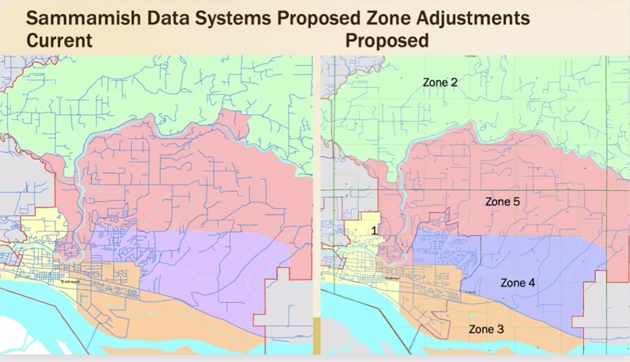
The Washougal School District (WSD) is looking at ways to readjust its board member zones based on population changes reflected in the 2020 United States Census data.
School districts are required to review their director zones after the completion of a census process to ensure equitable geographical representation for elections, according to a news release issued by the district.
“This is something that has to be done every 10 years,” Les Brown, WSD’s director of communications and technology, said during the Washougal School Board’s meeting on Sept. 13. “The goal of this process is to align the board of directors’ zones with census population estimates. There’s a state law that governs this that includes a whole bunch of factors, but the biggest thing is to make sure that each of the director districts are as nearly equal as possible in terms of the number of people in each one of them. We’re also supposed to make sure that they make sense regarding the geography of the district and, to the extent that it’s feasible, coincide with the natural topography and the existing boundaries.”
The district will post the current and proposed director zone maps on its website, and the board is set to vote on the proposed plan on Tuesday, Oct. 25.
The school district contracted with Sammamish Data Systems, a Redmond, Washington-based mapping company, in 2021, to develop a proposal for new director district boundaries based on the most recent census data.


